2006 01 21 Olinghouse, Humboldt River near Lovelock1
2006 01 22 Pyramid Lake, Smoke Creek
2006 02 19 Barstow to Salton Sea
2006 02 20 North Shore, Bombay Beach, Niland
2006 02 21 North Shore, Salton Sea Beach, Niland
2006 02 23 Niland, Salton Sea Beach
2006 02 24 Thermal, Salton Sea Beach
2006 02 18 Tonopah to Barstow
On the 17th I drove from Truckee to Tonopah. This is a relatively long drive, and I have done it many times. I left late, and would have loved to have been able to stop a few places, but I couldn't. I was hoping the weather would be bright in the Tonopah area so I could shoot a couple of sites I have had on my list for a while, but the weather speculators were wrong, and it was mostly gray.
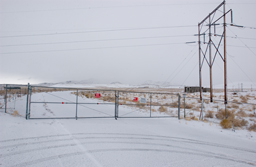
The following day, the 18th, I did go look at one of the sites I was interested in, and learned who I need to see about photographing it. It's an enormous gold mine northwest of Tonopah, and is unfortunately completely fenced. All I could do was look in. You can see it was a snowy gray day.
 |
 |
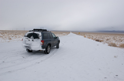 |
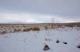
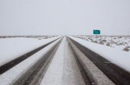
These next two shots were taken on US95 south of Tonopah. The elevation here is still between 5000 and 6000 feet, so it does get quite cold and it does snow. This turned into almost total whiteout after a while, and was slow going. This is a beautiful drive down western Nevada, so if any of you are ever headed from Lake Tahoe or Reno to Death Valley this is a route to consider. It does not look as direct as US395, which goes down the Owens Valley, but it is just as fast. Instead of seeing the east side of the Sierra Nevada and entering the park from the west you see miles of sage and enter the park from the east.
 |
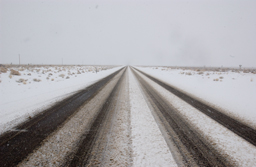 |
It was remarkable to have near whiteout turn into quite a sunny day just a few hours later and a couple of hundred miles further south.
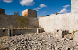
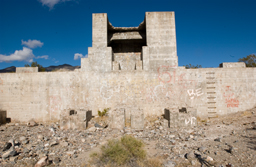
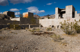
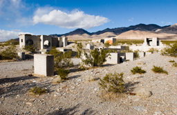
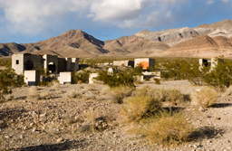
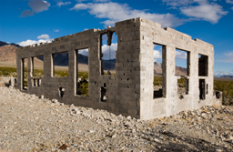
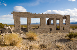
All of the next shots were taken at a site called Carrara, maybe a half mile to the east of US95, a few miles south of Beatty NV. There was a marble quarry here, and I assume it was named for the city of Carrara, Italy, which is noted for marble.
 |
 |
 |
 |
 |
 |
 |
 |
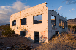 |
The upper six photos are what is left of what must have been the marble finishing facility. The whole expanse is quite large. The lower three shots are of what looks like an office building, or some other sort of administrative or support building.
I drove as far as Barstow CA, and stayed overnight there. (I am headed to the Salton Sea, in far south central CA.)
The US Army has a huge training facility near Barstow, Fort Irwin.
A few years ago (pre 9.11) I wanted to see the radio telescopes at Goldstone Observatory, and to do this you drive in the road that leads you to the main gate at Fort Irwin. Since I was on the road I thought I would see how far I could go. In those pre 9.11 days I was able to drive through the entrance gate to Fort Irwin, into the main complex, and just drive around. There were quite a number of people in civilian clothing, but there were also, of course, a lot of military personnel and vehicles. I just cruised around, had a nice self guided tour, and left.
I then went up into the hills toward Goldstone, where I was stopped by Wackenhut guards, asked my business, asked to fill out a visitor sheet, and allowed to drive the loop past all the rusting and abandoned 60s and 70s radio telescopes. I was directed not to leave the vehicle and not to drive off road. I also saw the currently operating telescopes but didn't have time to find out if I could see anything up close.
The contrast between security at Goldstone and at Fort Irwin was strange to say the least. Even stranger is to think about what security at Fort Irwin much be like now compared my pre 9.11 visit.